Sun Aug 25 2024
Coyote Gulch, Utah
Located in southern Utah, the Coyote Gulch trail meanders through a towering winding red rock canyon offering captivating views of natural arches and waterfalls.
Metadata
Trip Duration: 2 days, 1 night
Distance: ~8 miles one way plus more depending on how deep into the gulch you travel
Elevation Gain: ~800 ft
Trail Type: Out and back
Interesting sights: Jacob Hamblin Arch, Swiss Cheese Waterfall
Reservation: Not required
Cost: None. Perhaps a snack or two.
TLDR;
We hiked Coyote Gulch as a backpacking trip through the Hurricane Wash trail going up to the Swiss Cheese waterfall, spent a night in the canyons by the Jacob Hamblin Arch, and headed back the next morning. This route is relatively flat but beware, “hurricane wash” lives up to it’s name as there were several challenging areas where the trail was hard to find and overgrown. A machete would have been useful. Nonetheless, the views in the gulch were amazing and seeing the arch was worth every smack to the face. Going past the swiss cheese waterfall, you will end up at the natural bridge and another waterfall that leads into Escalante River.
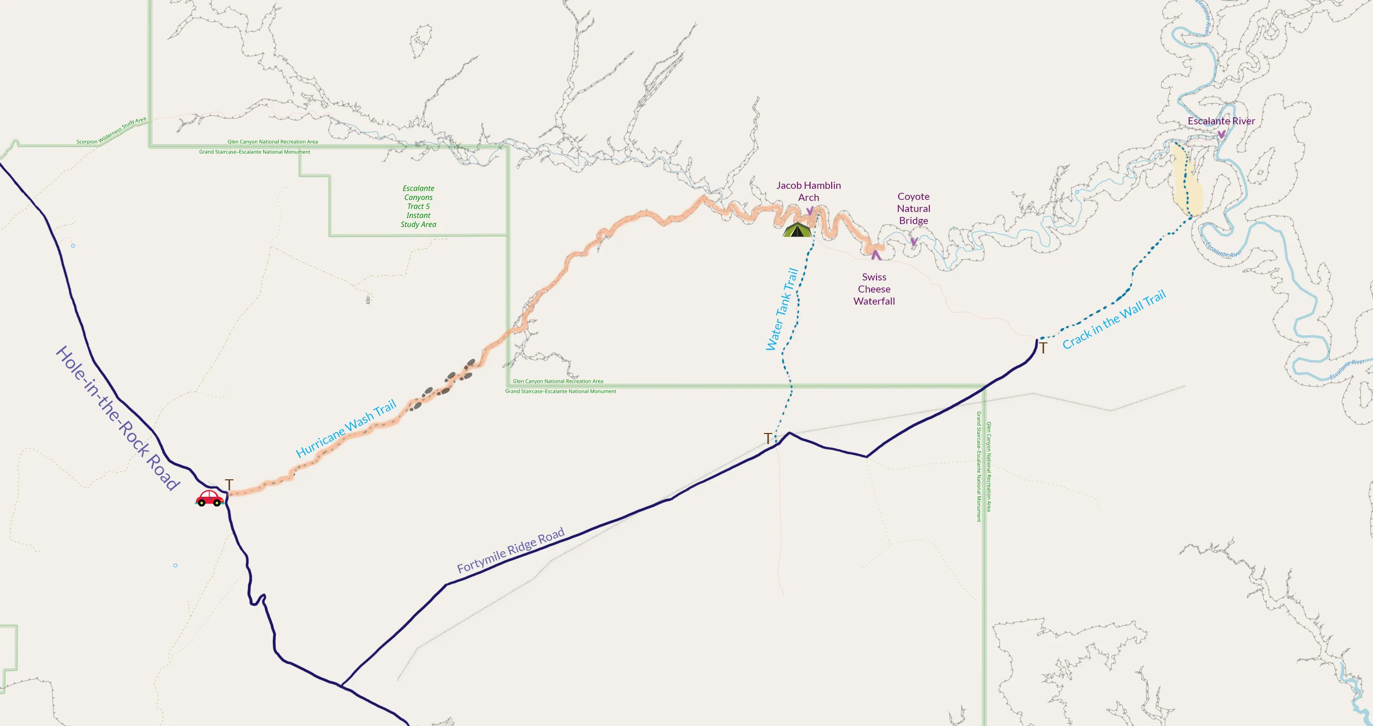
Hurricane Wash Trailhead
The nearest town is Escalante, UT, which is on Highway 12. Hurricane wash trailhead is located about 34 miles from Highway 12 off of Hole-in-the-Rock Road (BLM 200). This road is rocky and some areas may be hard to navigate after rain. An AWD vehicle will be useful.
Other hiking options
Crack in the Wall
There is an option to take another route back up at the Escalante River and loop back to the parking lot. This route might be tricky as it is narrow and requires a rope to haul your backpack up. The start of this trail is at the end of Fortymile Ridge Road, which forks from Hole-in-the-Rock Road.
Water Tank
The gulch can also be hiked as a day trip via this much shorter route but it requires bringing a rope to climb up and down the canyon wall. This hike also begins off of Fortymile Ridge Road.
Tips
- Keep an eye on the flash flood forcast. This area is prone to flooding in the fall months and flooding can occur without warning even if you don’t see rain on the horizon.
- Bring a long rope and go down Water Tank for a day trip if you don’t want to spend a night alone without a single human soul for miles.
- Sandals are useful for crossing streams.
- Wear pants while going through endless shrubbery.
- Keep sealed food nearby as there are thieves (rodents).
- Bug spray will be useful as there are mosquitos.
- Bring a water filter to refill on water from the stream.
Highlights
Jacob Hamblin Arch
Swiss Cheese Waterfall
Metate Arch
If you have time before or after the trip, check out the Metate arch, located on Hole-in-the-Rock Road.
The Rundown
How To Get There
The entrance road Hole-in-the-Rock Road can be accessed from Highway 12. From the town of Escalante, go East on Highway 12 for about 10 minutes before reaching Hole-in-the-Rock Road. If you’re coming from Boulder, go South on Highway 12 for about half an hour before reaching Hole-in-the-Rock Road. The trailhead will be 34 miles down this bumpy unpaved trail.
Day 1:
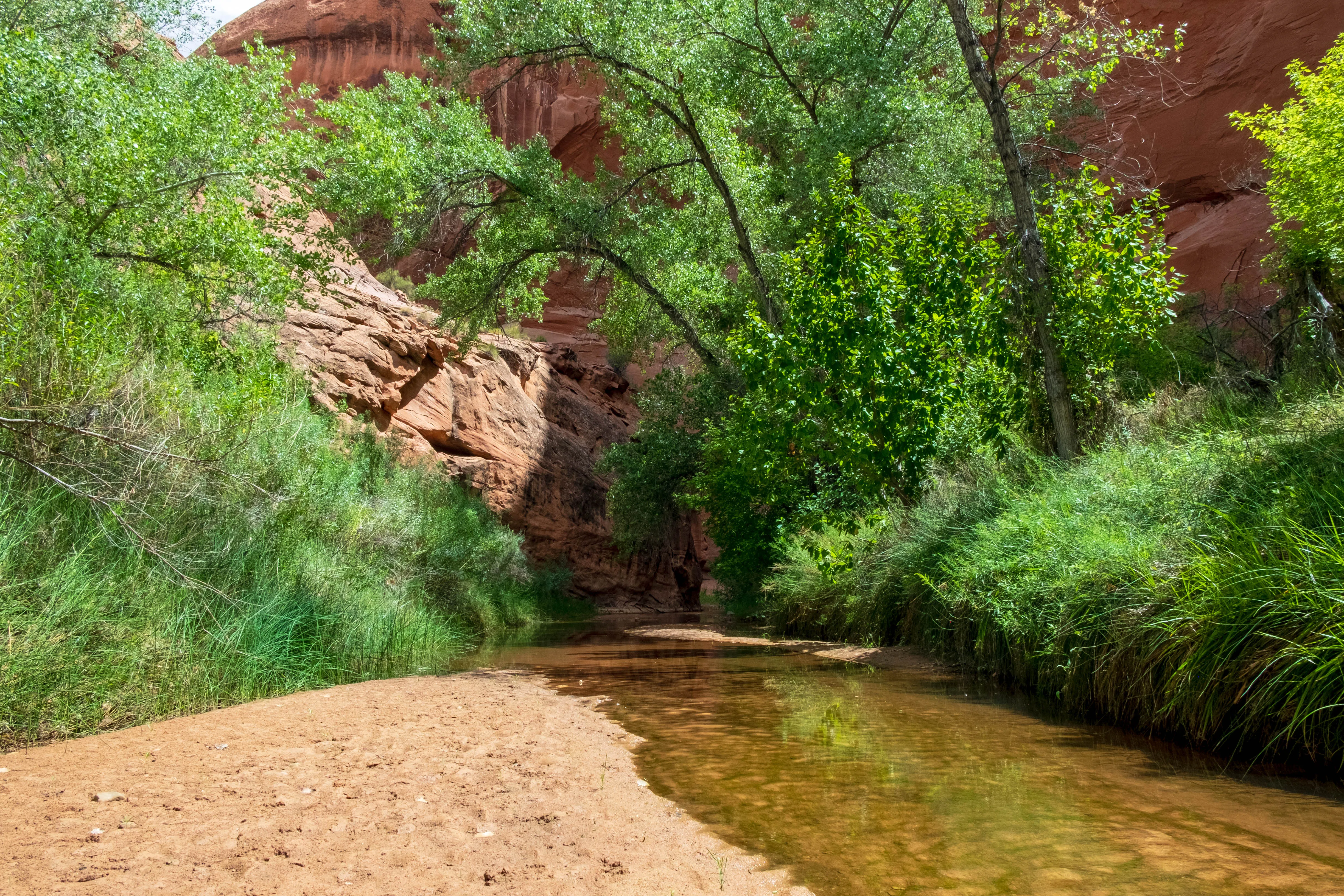
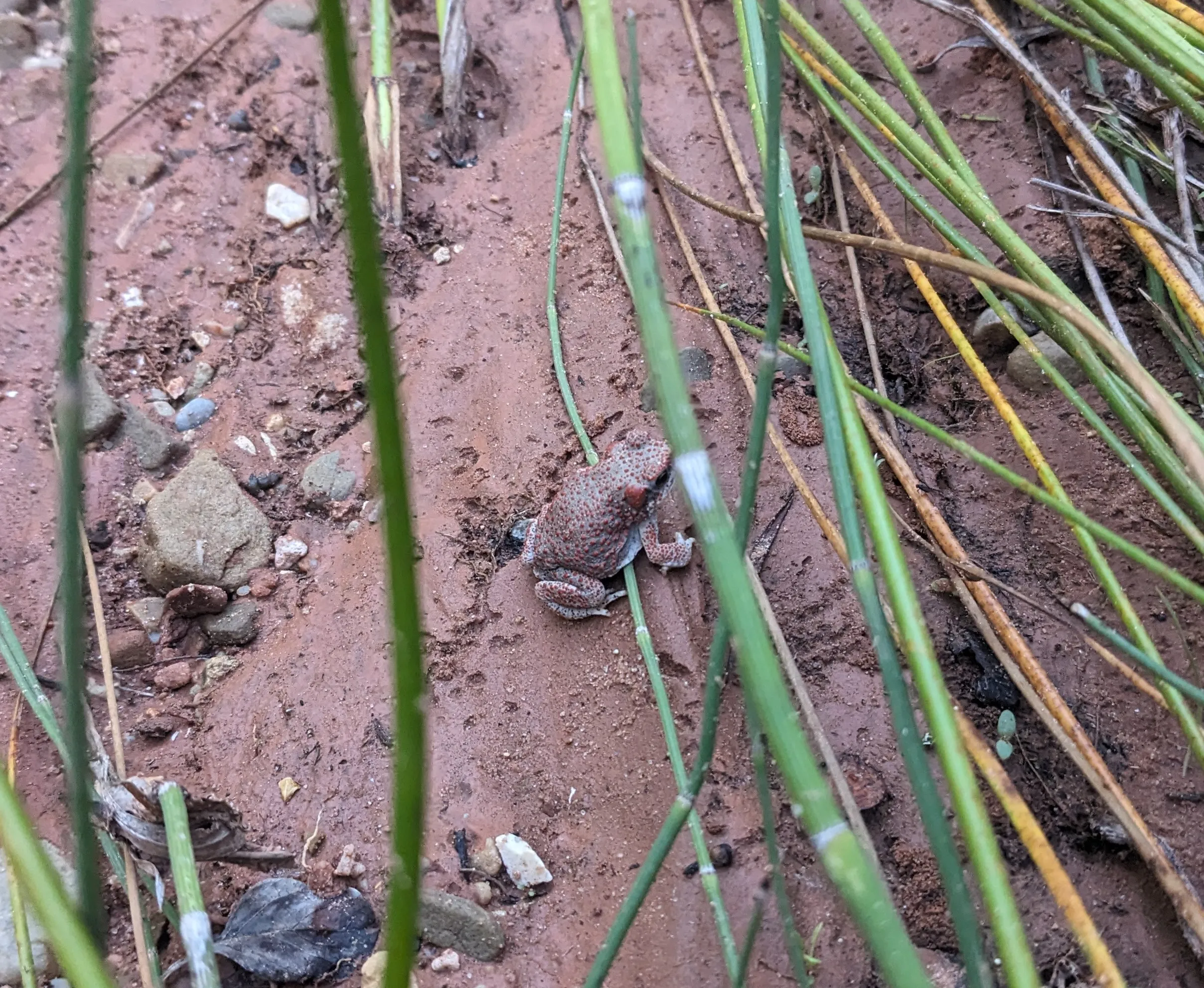
Starting at the hurricane wash parking lot, we were the only ones there (my car was probably lonely the entire trip). At the start of the trail, be sure to grab a permit and fill out the hikers log. The first few miles will be hiking through desert with very little shade but eventually it turns into a forest that follows a swampy stream. Be careful not to step on the little toads!
Try to find the trails that go inland around the bends of the stream as they are much easier to navigate. Eventually, you will arrive at a junction 6 miles in, which is the beginning of the gulch.
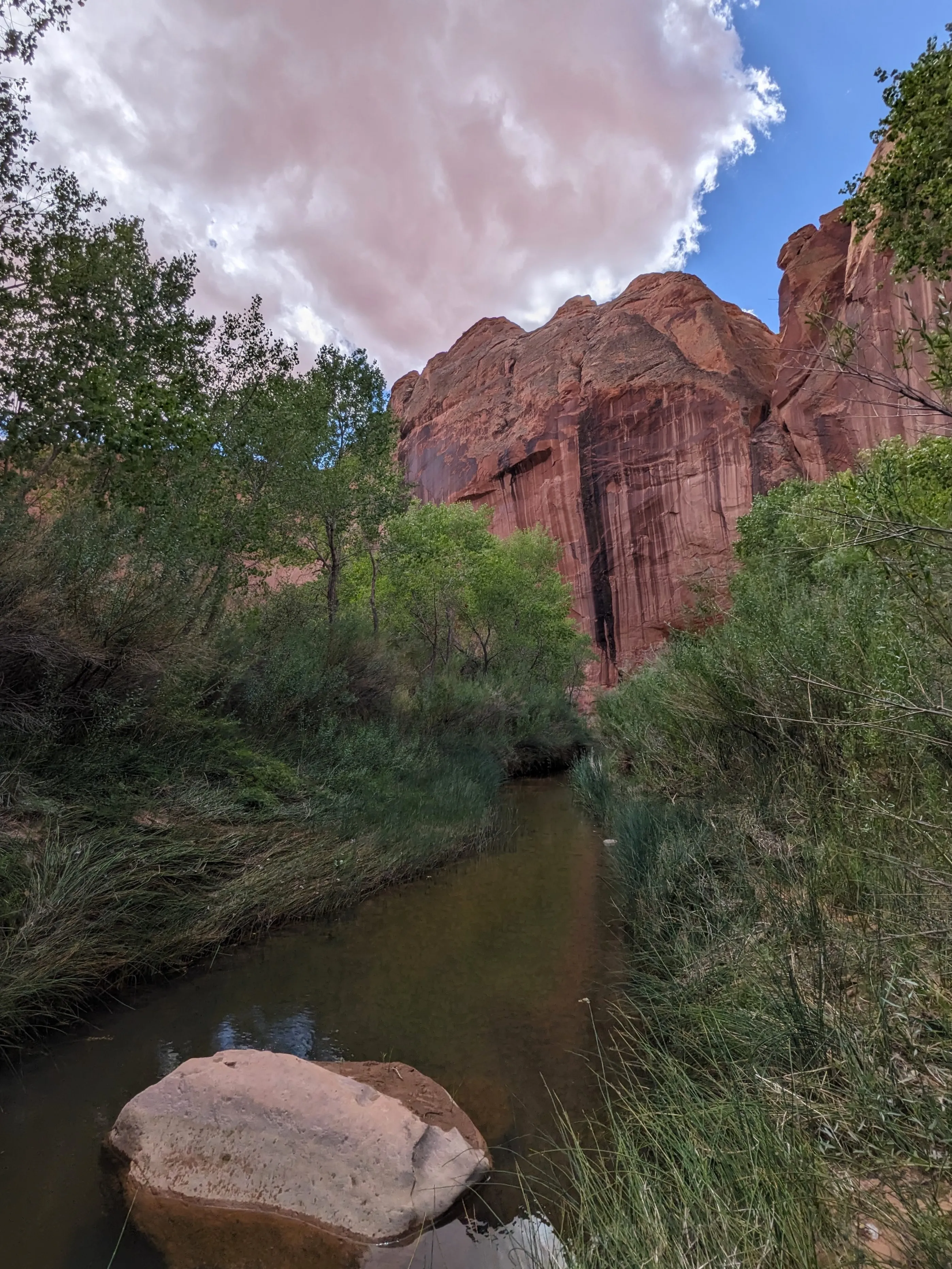
One more mile to the Jacob Hamblin Arch! I had high hopes for this.
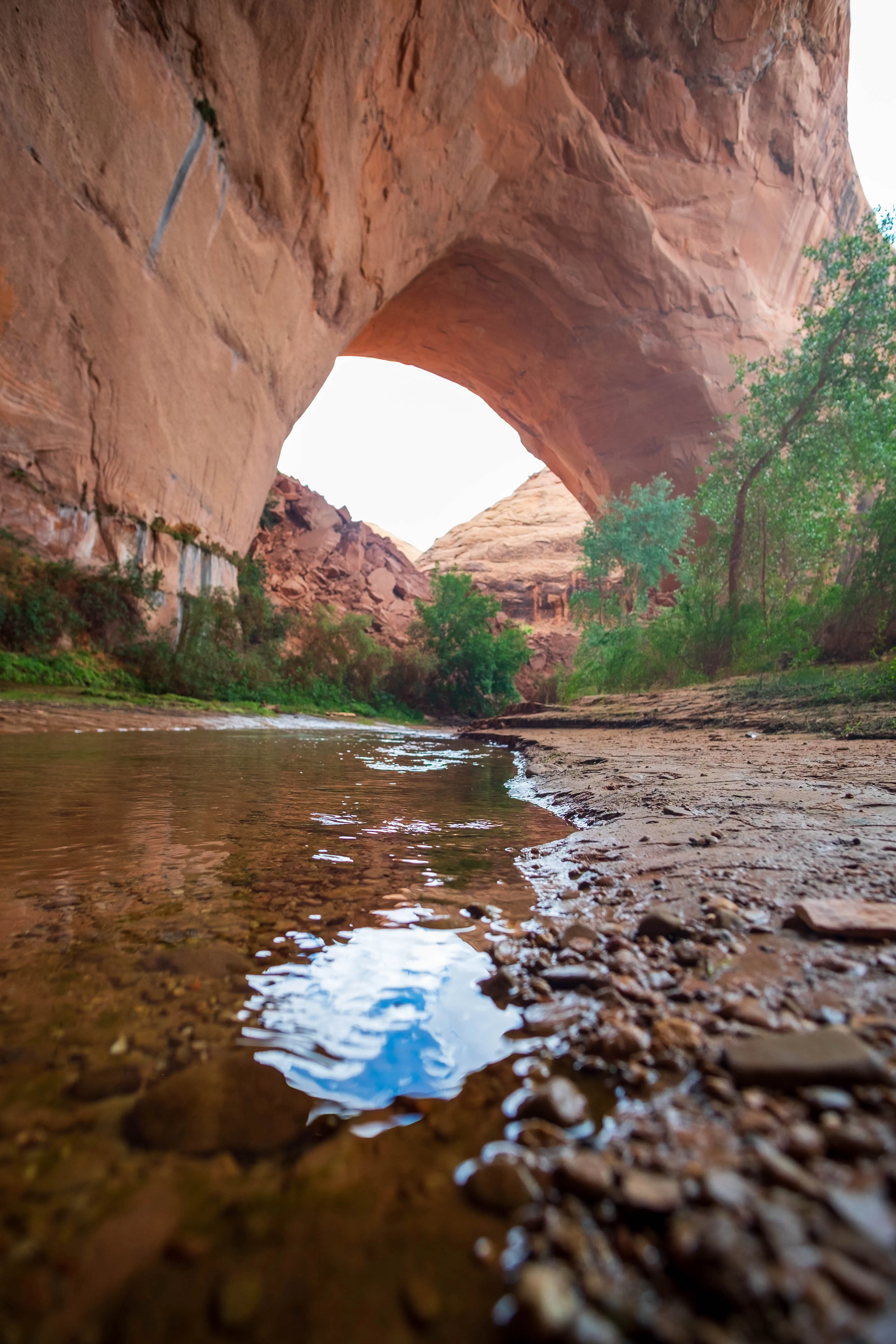
The “arch” might not be apparent at first, looking more like a hole in the wall, but this iconic view is more humbling in person.
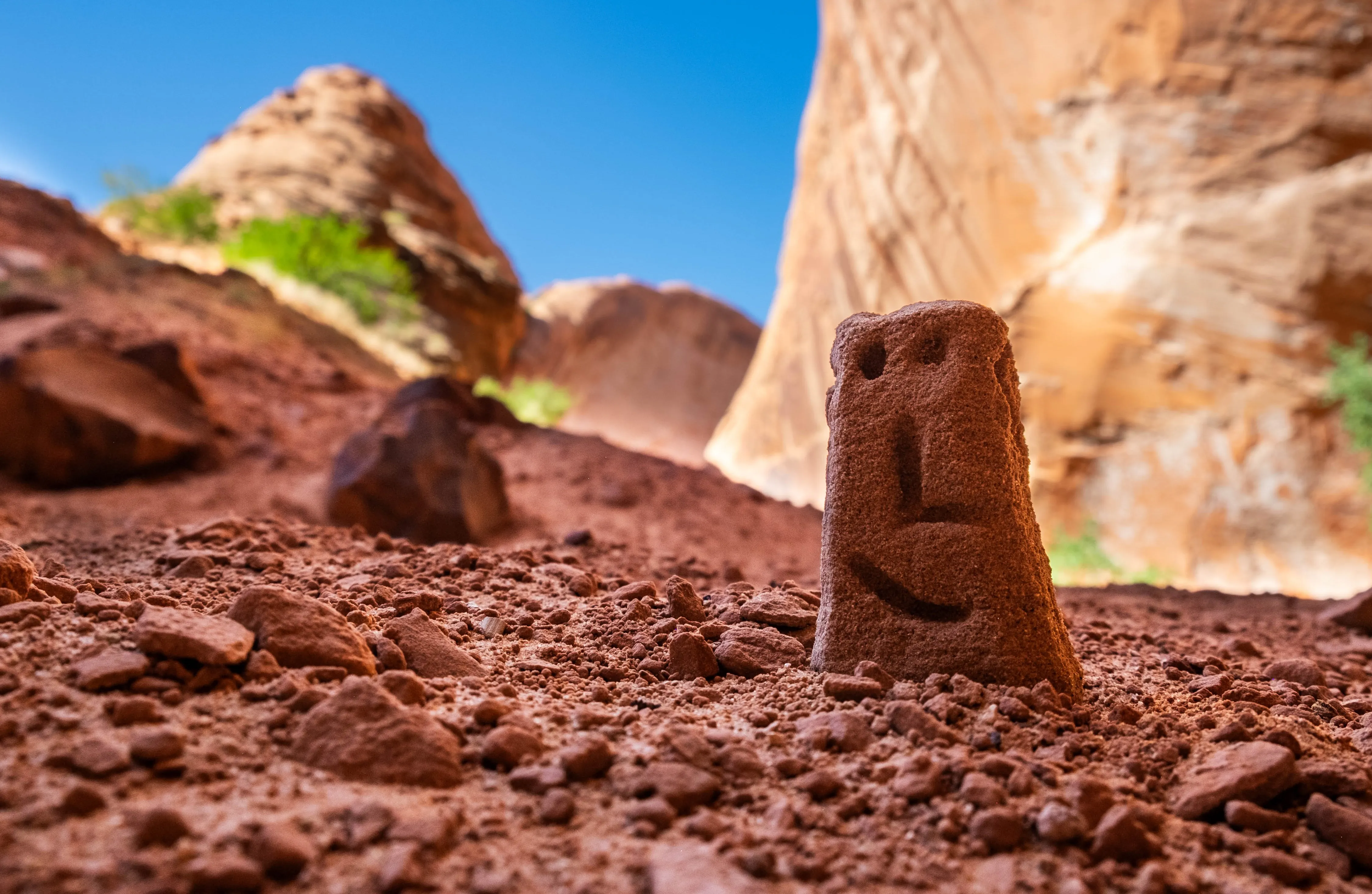
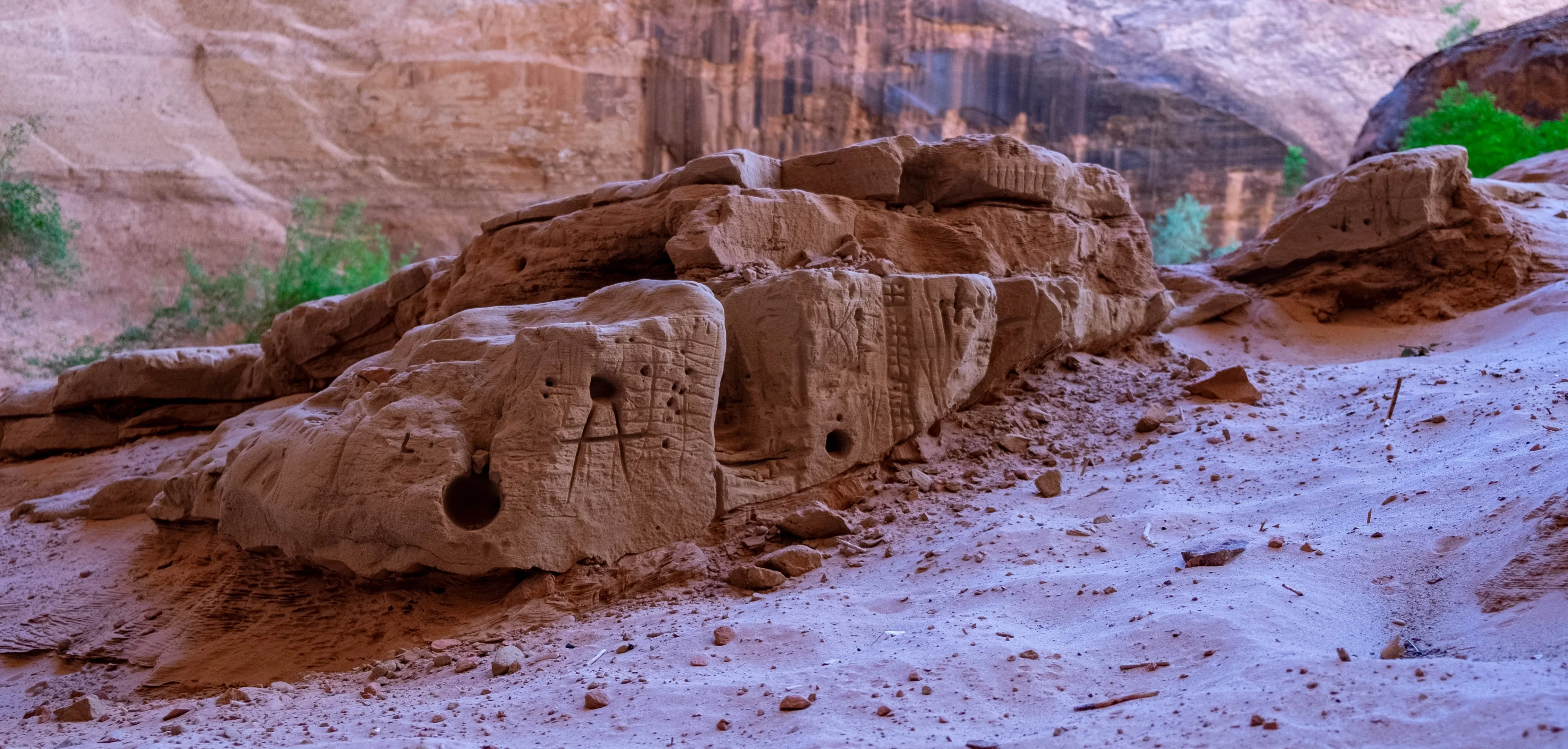
Going around to the other side of the arch, you’ll see a sandy hill with protruding rocks. People have carved designs and buildings into the sandstone, which made the layers of rock look like a city. Despite being super excited for the arch, this was actually my favorite part.
Not too much further is the Water Tank entrance into the gulch. We would not have known this had we not ran into a group of people lowering themselves with a rope. These were the only people we encountered.
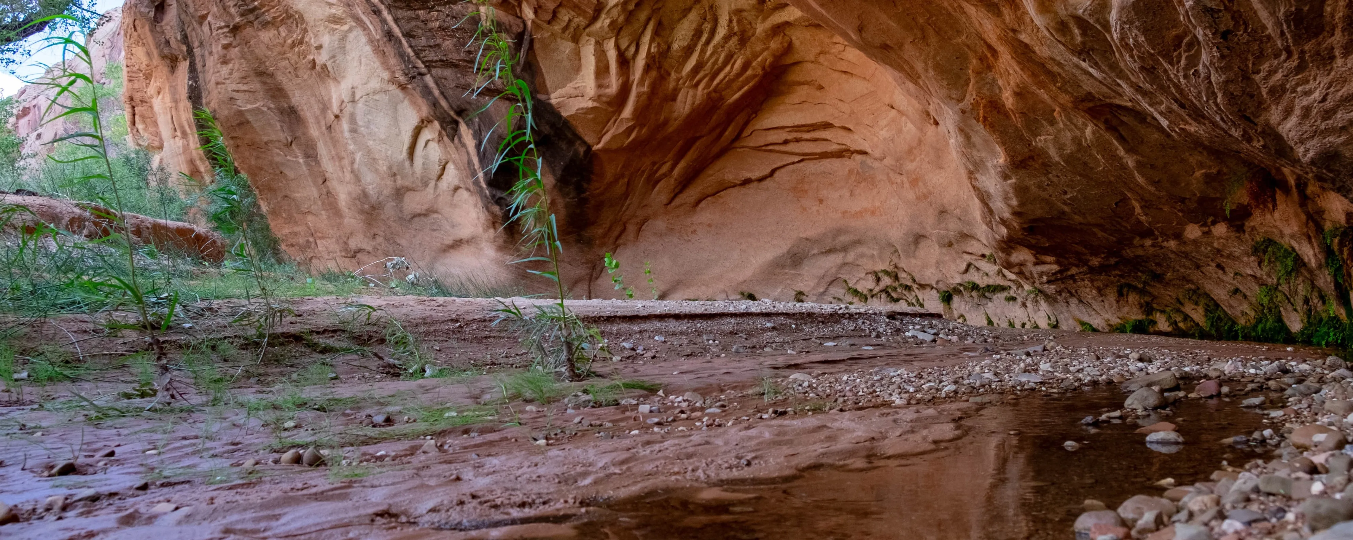
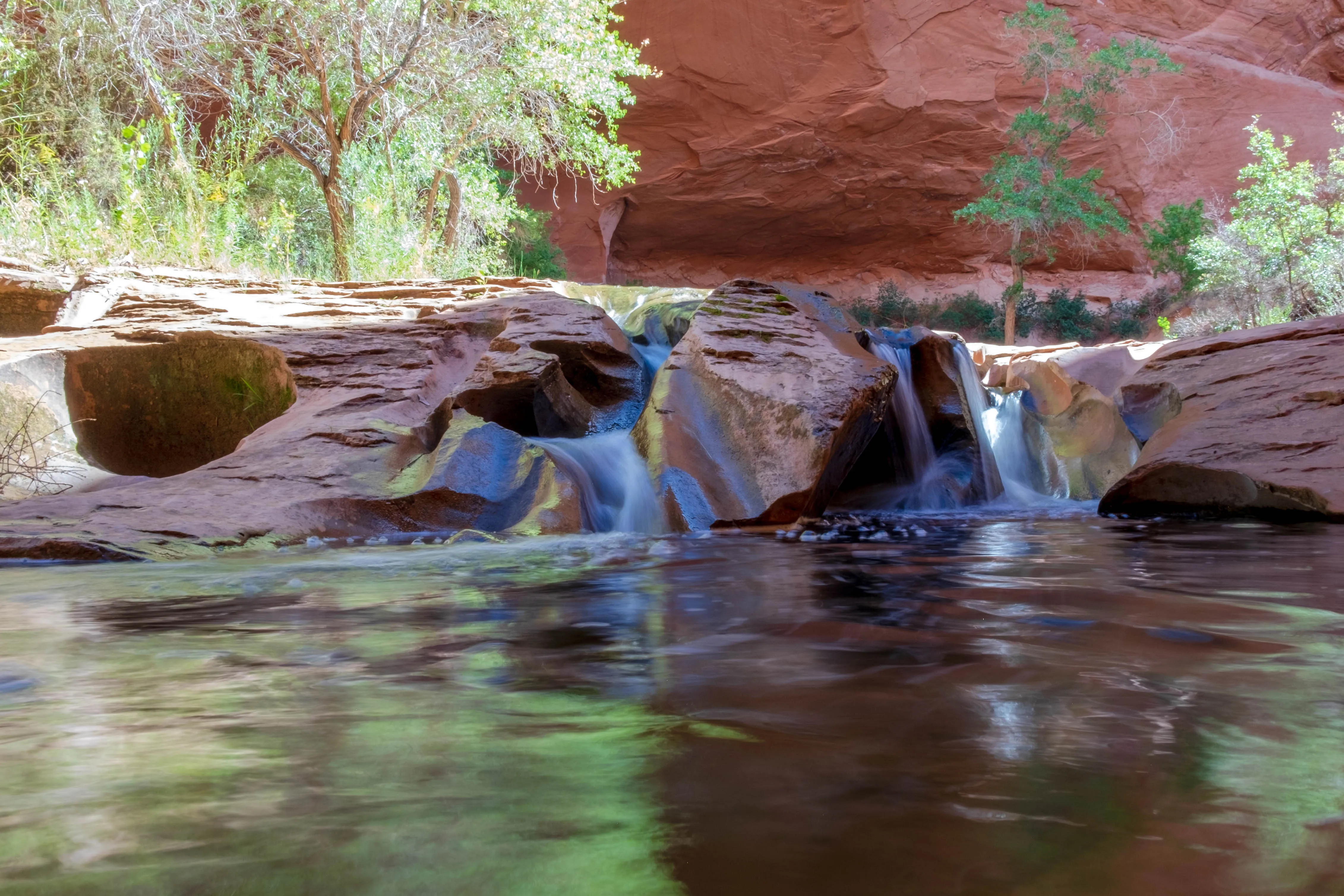
About two miles from the arch, you will arrive at the very aptly named Swiss Cheese waterfall. This is a good spot for a break and we decided to turn back here.
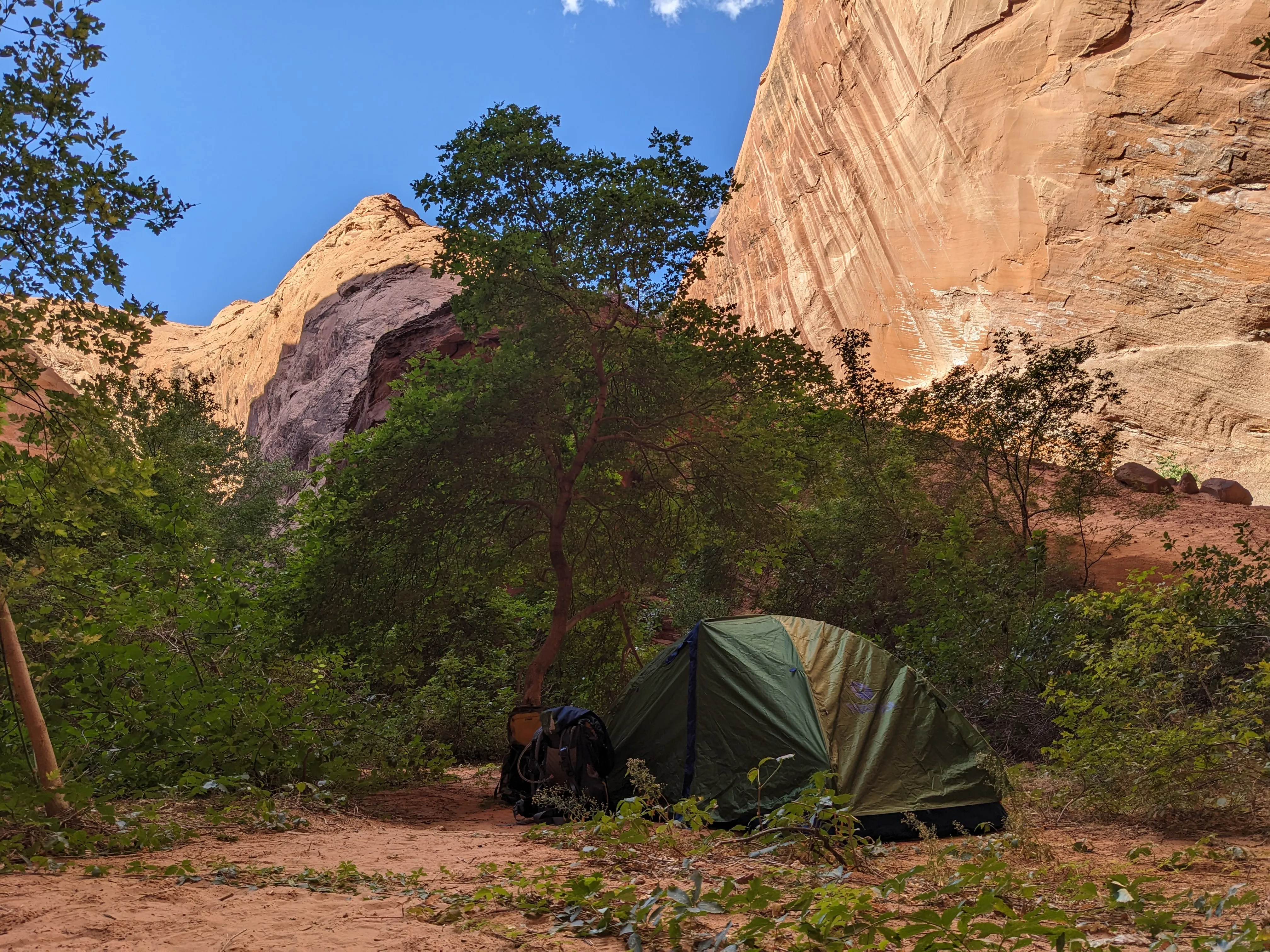
We found a nice campsite back by the rock carvings and set up tent for the night. After dinner and rest, we went back out for some long sought after night photography (really, this was the only reason I did not follow the group of people back up Water Tank to avoid the violent shrubs the next day).
The gulch was surprisingly dark at night with little views of the stars as the towering canyons got in the way. Nonetheless, I took a stab at some photos.
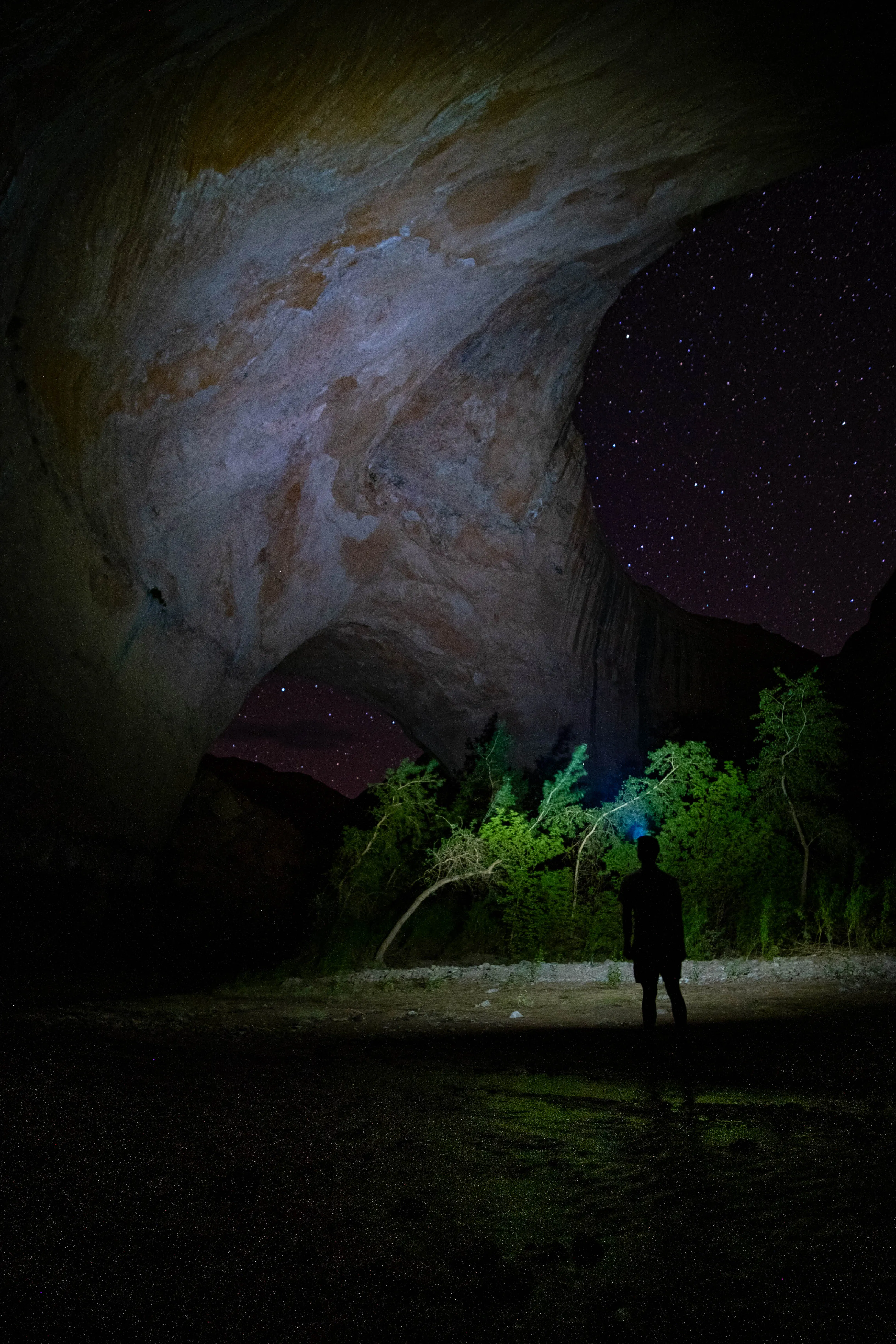
Tell me this wasn’t worth it.
Day 2:
There was not much going on the second day except the trek back to the car. We got up before the sun to avoid the afternoon heat back at the start of the trail. Don’t forget to fill up on water before heading out. I brought 2 litres and only had to fill up once.
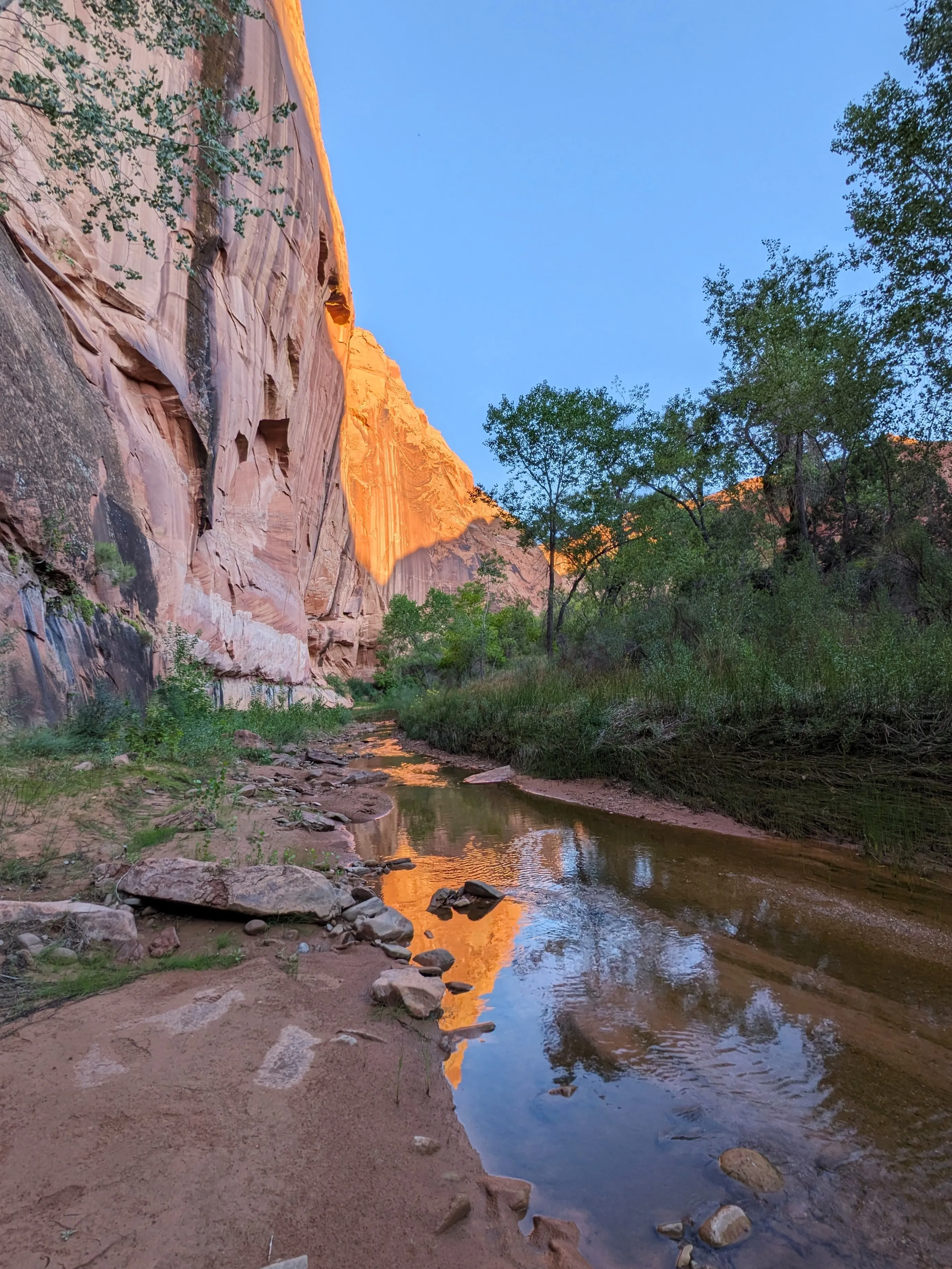
We were dreading having to go back through the bushes but the way back was actually so much easier knowing which path to take. Mornings are always so calm. You can see the glow of the sun on the tips of the canyon.
Memories
Most Useful Item
Sandals! For when you have to cross the stream or walk along the stream but you don’t want to risk getting your socks wet.
Favorite Meal
Dried vegetables (shiitake mushrooms and veggie mix like the kind that goes in ramen) mixed with quick cooking rice.
Favorite Snack
Spicy quail eggs from an Asian grocery store.
”The Case of the Missing Carrots”
So on day one we decided to leave our packs by the arch to keep exploring the area as we were the only ones in the gulch. In our sealed Ziplock bag full of snacks was another Ziplock bag of rainbow carrots. Of course we stored the precious goods safely inside the cinched up backpack. About an hour later, craving a refreshing snack, we returned to find a gaping hole in the larger Ziplock bag as if it was ripped open. A wave of confusion passes over me before I realize the missing bag of carrots! Where did the carrots go and why were these the only snack stolen? Were they snatched by some clever little creatures or did a hungry hiker forget how to open Ziplock bags? We will never know…